


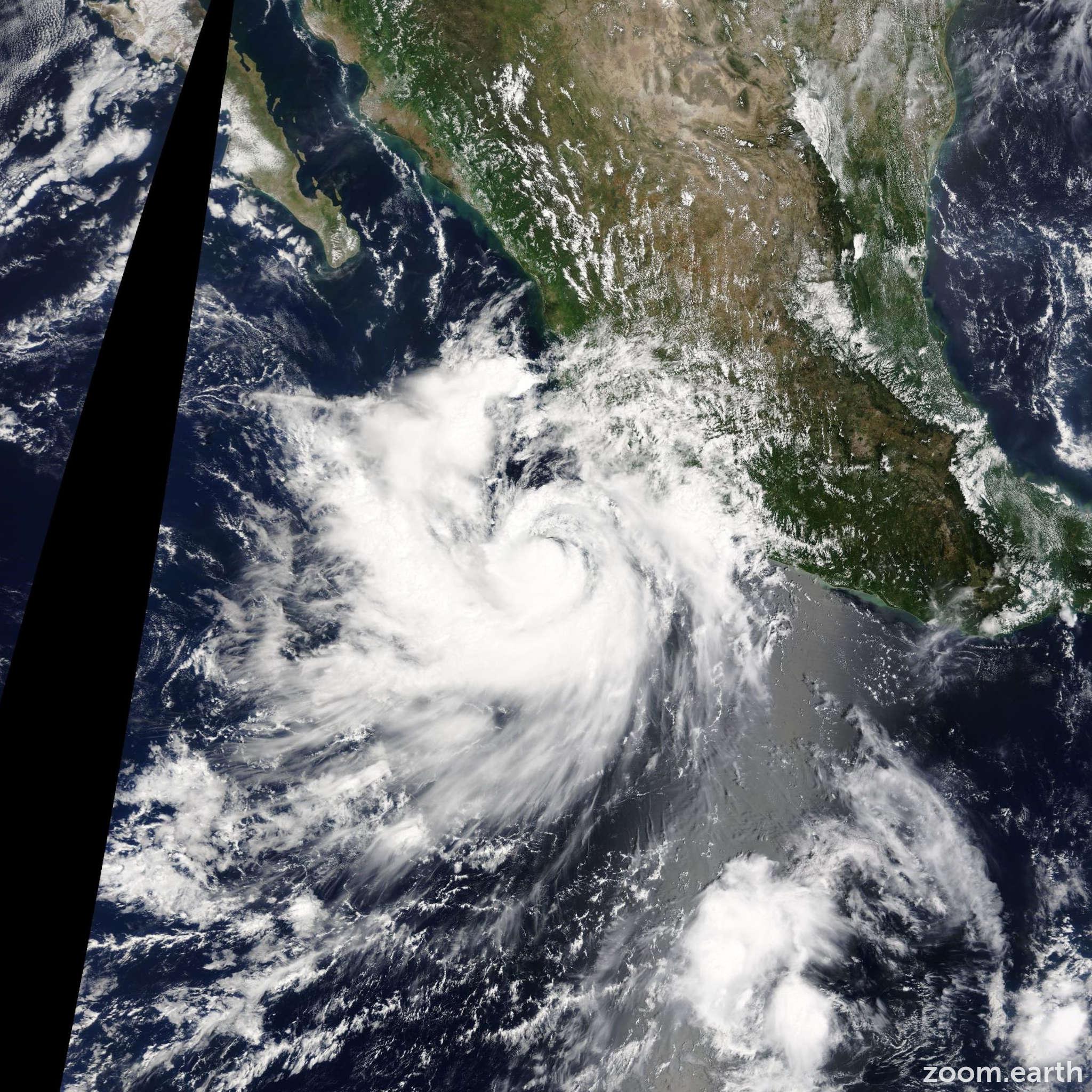
HOUSTON, Sept. 23, 2026 — Hurricane Polo is not expected to make landfall in Texas, but moisture associated with the powerful Pacific storm could become part of a larger weather pattern that brings heavier rain to parts of Texas next week, forecasters say.
Polo strengthened to a Category 5 hurricane on Tuesday, reaching peak winds of 180 mph, before weakening to a Category 4 storm on Wednesday. At midday Wednesday, the National Hurricane Center reported maximum sustained winds of 145 mph, with Polo moving northwest at about 5 mph off Mexico’s Pacific coast.
The storm itself is expected to remain away from Texas. The concern is what happens to the large amount of tropical moisture associated with Polo as it moves through the atmosphere.
How Polo’s moisture could affect Texas
Forecasters are watching whether moisture from Polo and another Pacific system, Hurricane Odalys, moves north and east toward the United States.
That moisture could interact with upper-level disturbances and a stalled or slow-moving frontal boundary over Texas. If those ingredients come together, they could increase the potential for periods of heavy rainfall and localized flooding in parts of the state.

The setup is still several days away, so exactly where the heaviest rain develops remains uncertain. But meteorologists are already watching the possibility because tropical moisture can travel far from the center of a hurricane.
Houston stays hot before the weather pattern changes
For the Houston area, the immediate forecast remains much more typical of late summer than fall.
The National Weather Service forecast issued Wednesday called for a high near 97 degrees with heat-index values reaching about 105. Temperatures were expected to remain in the 90s through the weekend, with highs around 94 Thursday, 93 Friday and about 93 Saturday and Sunday.
Rain chances increase toward the beginning of next week. The latest Houston forecast showed a 50 percent chance of showers and thunderstorms Tuesday, with a high near 91 degrees.
That means Houston residents could see a gradual transition from persistent heat toward a wetter pattern, although the exact timing and rainfall amounts will depend on how the larger weather systems evolve.
El Niño is adding another piece to the puzzle
The developing weather pattern is also occurring as El Niño strengthens across the Pacific.
Forecasters expect a very strong El Niño during the fall and winter of 2026-27. The phenomenon can influence atmospheric circulation and help transport tropical moisture farther north, potentially affecting weather across the southwestern United States and Texas.
However, El Niño does not provide a reliable timetable for Houston’s first major cold front.
A recent analysis of 23 El Niño fall seasons from 1951 through 2023 found that the average date for a 15-degree temperature drop in Houston was around Oct. 24 — close to the historical average outside El Niño years. Smaller and larger temperature drops have varied considerably from one year to another.
So while El Niño may contribute to the broader weather pattern, it does not mean Houston is guaranteed to experience an early arrival of fall.
What Houston residents should watch next week
The main issue for residents is not a hurricane strike from Polo, but the possibility of tropical moisture contributing to heavier rainfall.
Residents should watch for:
- Updates on rainfall chances as Polo and Odalys move farther across the Pacific.
- Possible thunderstorms and periods of heavy rain early next week.
- Localized street flooding, particularly in low-lying areas and places that typically drain slowly.
- Changes to travel conditions if heavy rain develops during commuting hours.
- Any watches, warnings or flood advisories issued by the National Weather Service or local authorities.
What this means for Houston’s Pakistani community
For Houston’s Pakistani and wider South Asian community, the developing weather pattern is particularly relevant for weekend travel, community gatherings, outdoor events and family activities.
Many families may already be making plans for weddings, community programmes, sports, religious gatherings or other outdoor activities as temperatures begin to ease. If rain chances increase next week, organizers and families should keep checking the forecast rather than relying on today’s conditions.
Households should also be prepared for the possibility of a rapid change from extreme heat to thunderstorms. Keeping basic rain gear, flashlights and emergency supplies accessible can be useful, particularly for families travelling across the greater Houston area.
For those commuting between Houston and surrounding communities, heavy downpours can quickly reduce visibility and create standing water on roads. Drivers should avoid entering flooded roadways and check weather and traffic conditions before longer trips.
The same preparation applies to families planning outdoor events: a storm does not have to be a hurricane to create dangerous lightning, strong winds, poor visibility or localized flooding.
The bottom line
Hurricane Polo is not currently a direct hurricane threat to Texas. Its moisture, however, could become part of Texas’ weather story next week.
With El Niño strengthening, another Pacific hurricane developing and a possible frontal boundary approaching Texas, forecasters will be watching closely to see whether these systems combine to produce a wetter and potentially cooler pattern.

