


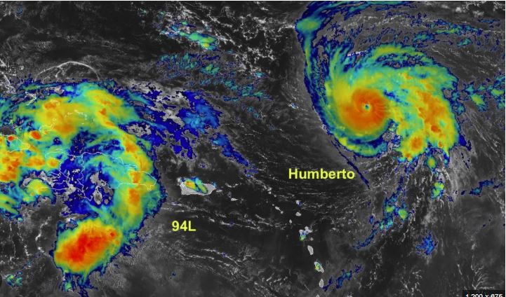
A new tropical system is developing in the Atlantic Ocean and could threaten the Southeast US early next week. The storm, currently labeled Potential Tropical Cyclone Nine, was designated late Friday near the southeastern Bahamas.
The National Hurricane Center (NHC) uses this label for disturbances that have not yet developed into tropical storms but may bring hazardous conditions within 72 hours.
As a precaution, a tropical storm warning has been issued for the central Bahamas, while a tropical storm watch covers northwestern parts of the islands.
Path and Strength of Potential Imelda
Forecasters expect the system to strengthen into a tropical depression by Saturday and then become Tropical Storm Imelda by Saturday night. By Monday, it may even grow into a Category 1 hurricane, with landfall possible by Tuesday along the US Southeast coast.
Early projections show the storm stalling near the South Carolina coast as a Category 1 hurricane on Tuesday, raising concerns for flooding and storm surge.
Hurricane Humberto Intensifies
Meanwhile, Hurricane Humberto has rapidly intensified into a Category 3 storm over the central Atlantic. It is forecast to reach Category 4 strength with winds of 145 mph by Sunday.

Humberto is not expected to make landfall in the US but could affect Bermuda next week. Its size and track may influence how quickly Imelda strengthens and which path it takes.
Storm Interaction: The Fujiwhara Effect
Meteorologists warn that if Humberto and Imelda move close enough together, they could interact through a rare phenomenon called the Fujiwhara effect, in which two storms circle around each other. Though possible, this scenario now appears less likely.
A weaker Imelda could be drawn harmlessly out to sea, while a stronger and faster Imelda may resist and head toward the US coastline.
Threats to the Southeast US
Even if the system does not make direct landfall, the Carolinas and coastal Georgia remain at highest risk for:
- Heavy rainfall and widespread flooding
- Storm surge and coastal flooding
- Strong winds and beach erosion
- Dangerous rip currents across the Eastern seaboard
A troubling possibility is that Imelda could stall near the coast, unleashing days of relentless rainfall and causing rivers and streams to swell, similar to previous major flood events in the Southeast.
What Residents Should Do Now
With uncertainty still high, anyone from the Bahamas to the US East Coast should closely monitor forecasts over the weekend.
This system is developing close to land, leaving a very narrow window to prepare for:
- Flash flooding and prolonged rain
- Coastal impacts including storm surge and erosion
- Hazardous surf and rip currents along the Atlantic beaches

