


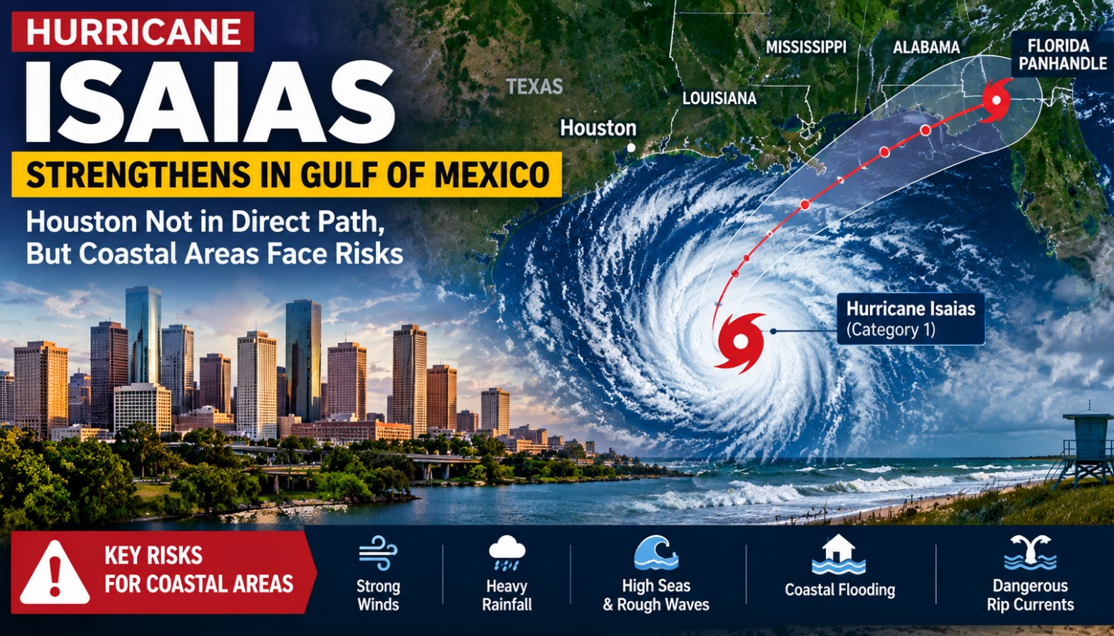
10th October 2026 _ Isaias has become the first hurricane of the 2026 Atlantic hurricane season, after strengthening over the Gulf of Mexico.
The storm is now heading toward the northern Gulf Coast, with the current forecast taking it toward the Mississippi, Alabama and Florida Panhandle coastline. Forecasters warn of potentially dangerous hurricane-force winds, heavy rain, storm surge and flooding in areas closer to the projected path.
But for people in Houston, the big question is: Are we in danger?
At this point, Houston is not expected to face a direct impact from Isaias. The National Weather Service in Houston-Galveston says no significant impacts are expected across Southeast Texas because the storm is forecast to turn northeast and move farther east across the Gulf.
That doesn’t mean there is nothing to watch.
The main concern for the Houston-Galveston region is along the coast and in the Gulf waters. Stronger winds and larger waves are expected offshore, while coastal areas could see minor flooding and an increased risk of dangerous rip currents later this week.

The National Weather Service has issued a Small Craft Advisory for parts of the Gulf waters off the Texas coast. Nearshore seas could reach around *4 to 7 feet, with offshore seas potentially reaching *7 to 9 feet. Small boats and inexperienced mariners are being advised to avoid these conditions.
For Houston itself, the forecast remains much quieter. Thursday is expected to be warm and mostly dry, with temperatures around the low 90s. The chance of rain is higher near the coast and offshore than across the Houston area.
Why is Isaias moving away from Texas?
Weather patterns over the Gulf are helping steer the storm toward the northeast. A dip in the jet stream over the northwestern Gulf, combined with high pressure farther east, is helping push Isaias away from the Texas coast and toward the central and eastern Gulf Coast.
So, for Houston residents, there is no reason for hurricane-level panic right now.
But if you’re heading to Galveston or other Gulf-facing beaches, boating, fishing or spending time near the water, conditions deserve attention.
The storm is also affecting offshore energy operations. Major companies including Shell and Chevron have reduced some Gulf of Mexico production and moved personnel as a precaution.
Bottom line: Isaias is a significant Gulf hurricane, but Houston is currently outside the direct threat zone. The immediate Houston-area concern is mainly hazardous Gulf conditions, stronger rip currents and possible minor coastal flooding.
As always, check the latest National Weather Service updates before heading to the coast.

